Research Directions
Our research focuses on understanding, predicting, and assessing hydroclimate extremes in a warming climate. We combine climate observations, model simulations, hydrological modelling, machine learning, and probabilistic risk analysis to study floods, droughts, heatwaves, and compound water-related hazards across regions and scales.
Compound Events
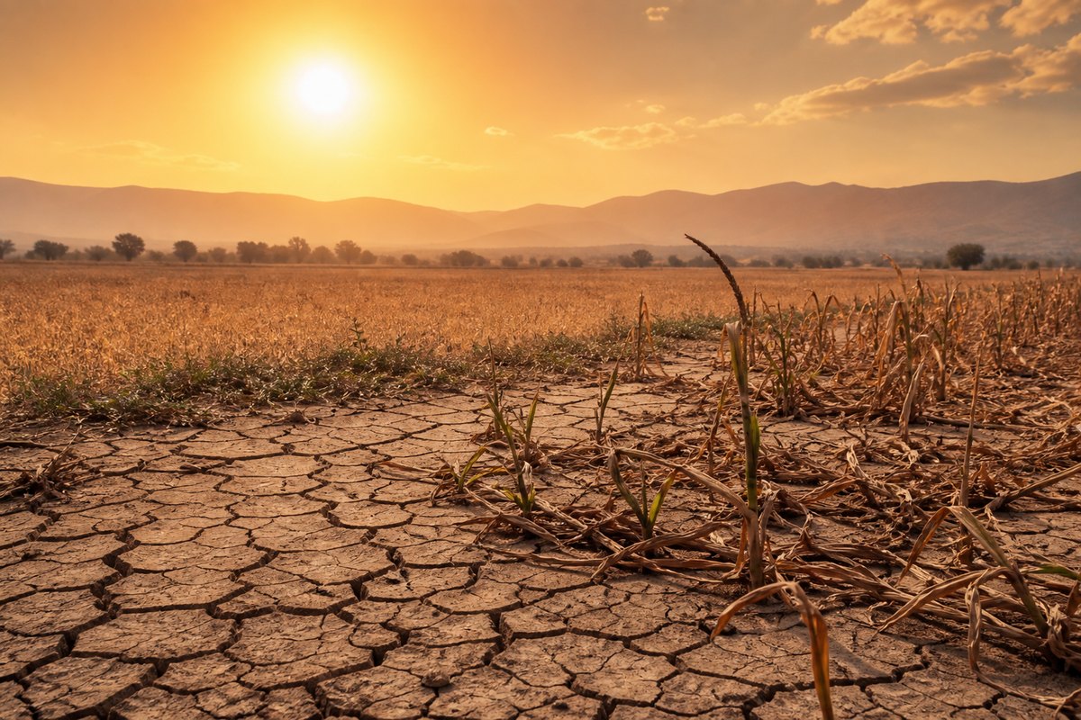
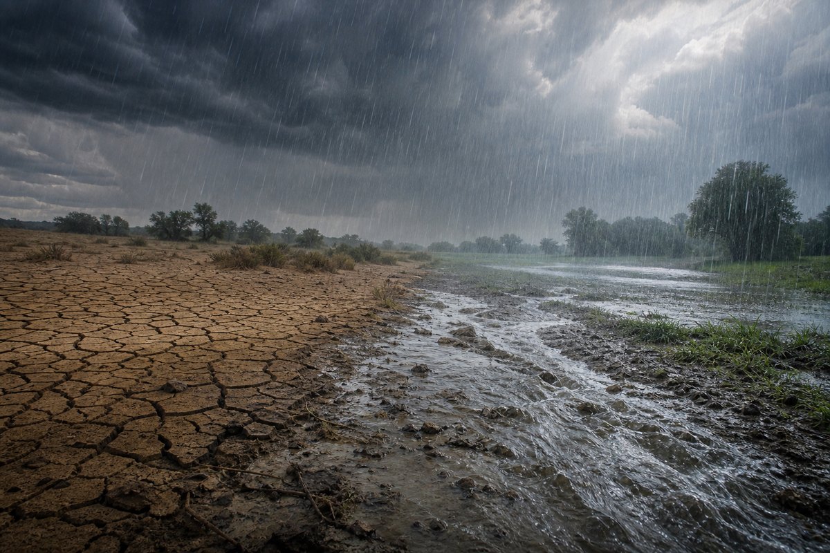
We study how and why compound events, including concurrent droughts and heatwaves as well as dry-wet abrupt alternation, are changing in a warming climate and what those changes mean for ecosystems, infrastructure, and society.
Climate Extremes and Inequality
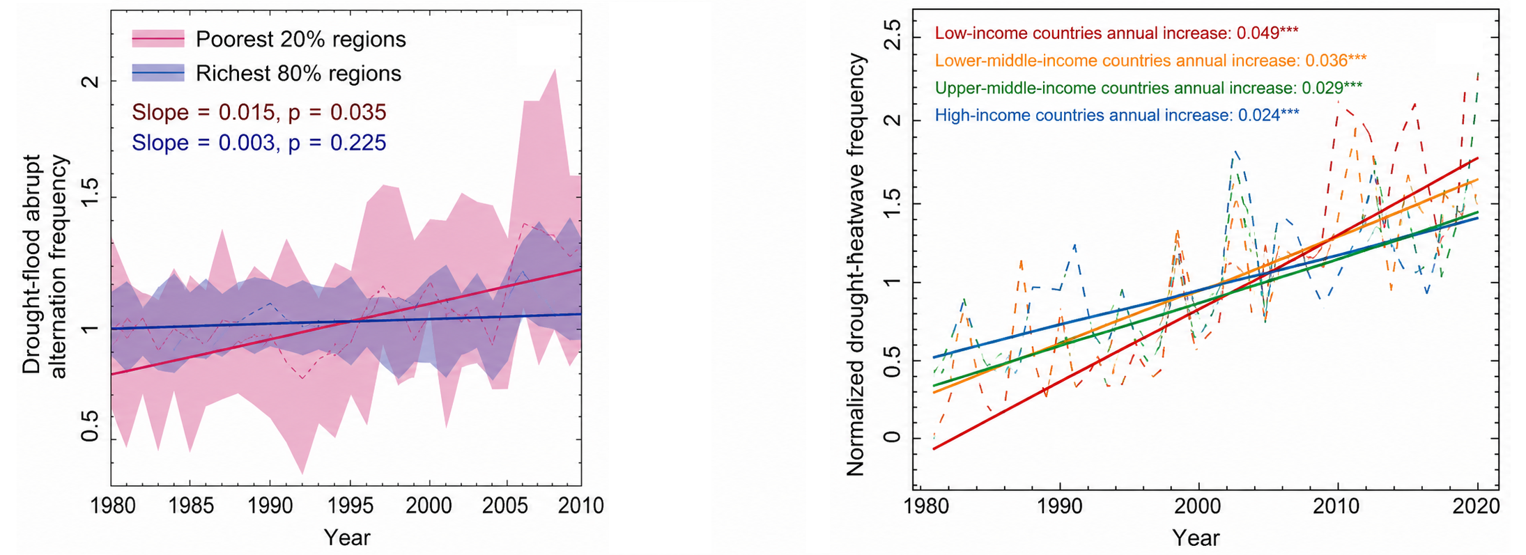
Climate extremes do not affect all communities equally. We study how floods, droughts, heatwaves, and compound events interact with socioeconomic vulnerability, exposure, and adaptation capacity to understand who is most affected by emerging climate risks and why. Using observations and climate models, we find a significant increase in drought-downpour abrupt alternation events experienced by the poorest 20% of regions, while the wealthiest 80% of regions show no significant change (left figure). We also find that low-income regions experienced a 377% [351-403%] increase in compound drought-heatwave frequency from 1981 to 2020, about twice the increase observed in high-income regions (184% [153-204%]). Without anthropogenic climate change, compound drought-heatwaves would not have increased in low-income regions, but would still have risen in high-income regions (right figure).
Multivariate Assessment of Hydrologic Extremes
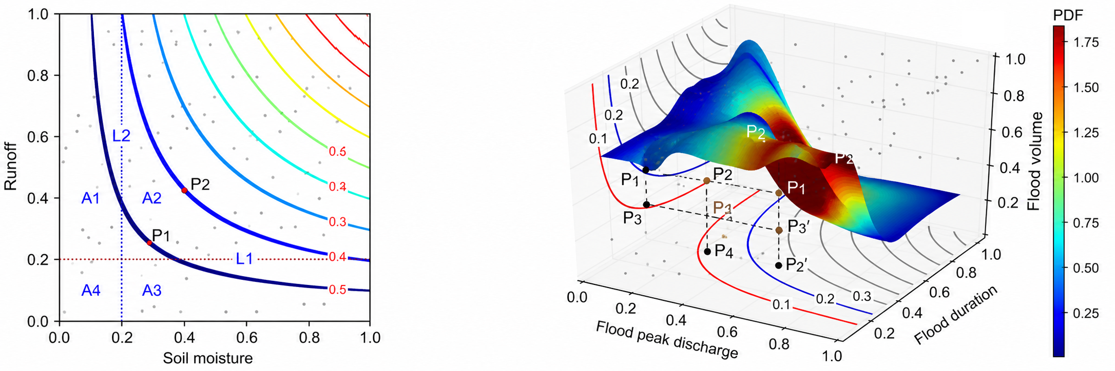
We use multivariate statistics to improve assessments of floods and droughts. For drought risk, copula-based methods allow us to develop a multivariate drought index that accounts for the combined effects of runoff and soil moisture deficit (left figure). For flood risk, vine copulas help improve risk assessment and design flood estimation by explicitly characterizing the dependence among flood peak, flood duration, and flood volume (right figure).
Hydrological Forecasting
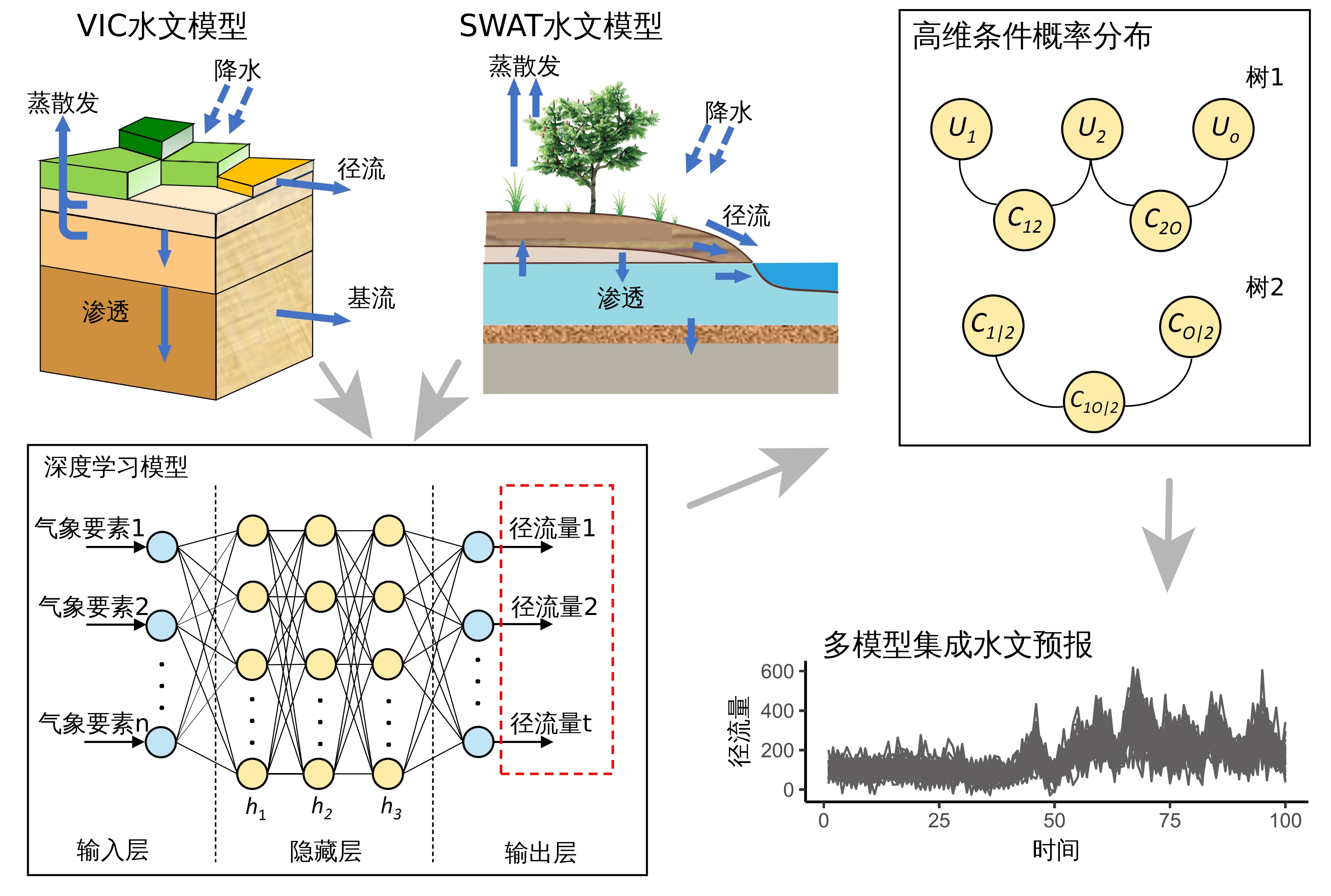
We develop data-driven and process-based approaches for hydrological forecasting across river basins and larger spatial scales. This work integrates climate information, hydrological models, river-network data, and machine learning methods to improve prediction of water-related hazards from local catchments to global river systems.
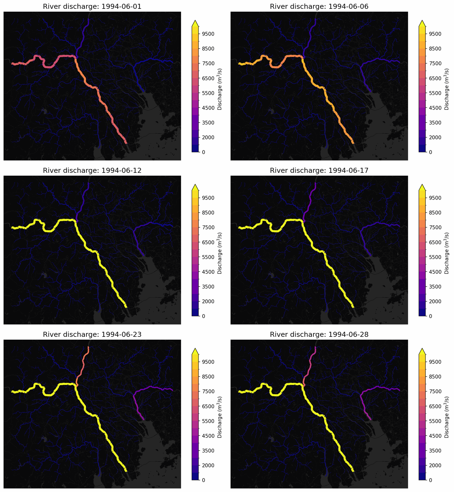
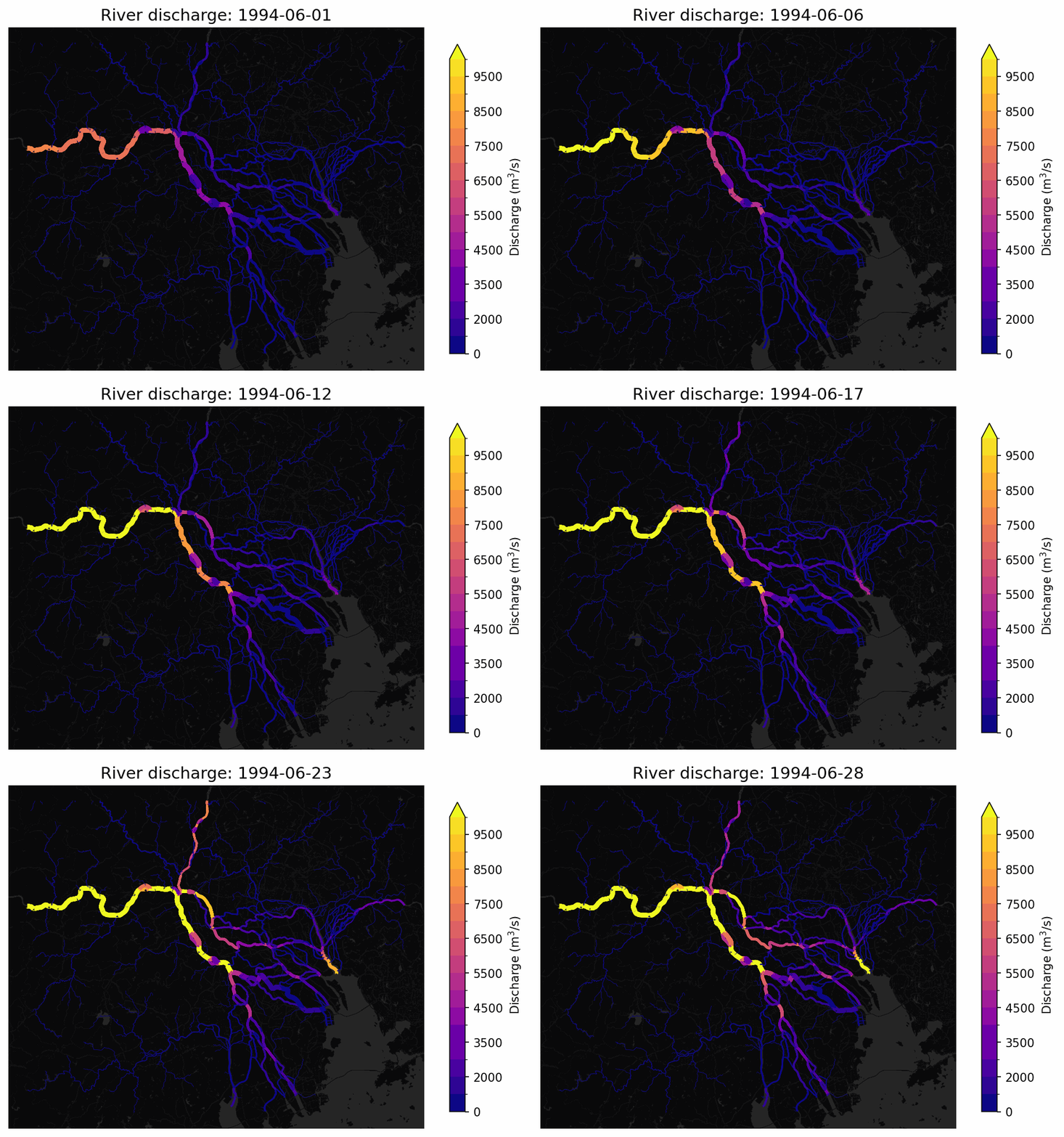
The two animations below show simulated daily river discharge during a major flood in the Pearl River Basin in June 1994, with the maps focused on the Pearl River Delta. Brighter and wider moving signals indicate stronger streamflow propagating downstream through connected channels. Comparing the MERIT Hydro and GRIT Hydro simulations highlights how traditional tree-based hydrography can create spatial mismatches in river-network representation, which may propagate into flood-risk mapping and hydrological forecasting.